


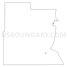
Precinct 1, Pershing County, Nevada
About
Outline
Summary
| Unique Area Identifier | 615455 |
| Name | Precinct 1 |
| County | Pershing County |
| State | Nevada |
| Area (square miles) | 3,494.43 |
| Land Area (square miles) | 3,470.86 |
| Water Area (square miles) | 23.57 |
| % of Land Area | 99.33 |
| % of Water Area | 0.67 |
| Latitude of the Internal Point | 40.48757000 |
| Longtitude of the Internal Point | -118.82407640 |
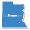
Maps

Graphs
Select a template below for downloading or customizing gragh for Precinct 1, Pershing County, Nevada


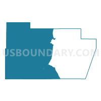
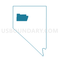
Neighbors
Neighoring Voting District (by Name) Neighboring Voting District on the Map
- Voting District 8, Humboldt County, NV
- CHURCHILL PRECINCT 09, Churchill County, NV
- CHURCHILL PRECINCT 16, Churchill County, NV
- CHURCHILL PRECINCT 17, Churchill County, NV
- Precinct 3, Pershing County, NV
- Precinct 4, Pershing County, NV
- Precinct 5 Imlay, Pershing County, NV
- Precinct 7, Pershing County, NV
- Precinct No. 7423, Washoe County, NV
- Precinct No. 7521, Washoe County, NV
- Precinct No. 7531, Washoe County, NV
- Precinct No. 9521, Washoe County, NV
Top 10 Neighboring County Subdivision (by Population) Neighboring County Subdivision on the Map
- Winnemucca CCD, Humboldt County, NV (13,532)
- Lovelock CCD, Pershing County, NV (4,839)
- Imlay CCD, Pershing County, NV (1,914)
- Pyramid Lake CCD, Washoe County, NV (1,654)
- High Desert CCD, Washoe County, NV (567)
- Summit Lake CCD, Humboldt County, NV (318)
- Dixie Valley CCD, Churchill County, NV (170)
- Carson Sink CCD, Churchill County, NV (29)
Top 10 Neighboring Place (by Population) Neighboring Place on the Map
Top 10 Neighboring Unified School District (by Population) Neighboring Unified School District on the Map
- Washoe County School District, NV (421,407)
- Churchill County School District, NV (24,877)
- Humboldt County School District, NV (16,528)
- Pershing County School District, NV (6,753)
Top 10 Neighboring State Legislative District Lower Chamber (by Population) Neighboring State Legislative District Lower Chamber on the Map
- Assembly District 32, NV (80,177)
- Assembly District 38, NV (66,836)
- Assembly District 35, NV (51,108)
Top 10 Neighboring State Legislative District Upper Chamber (by Population) Neighboring State Legislative District Upper Chamber on the Map
- Washoe County Senatorial District 2, NV (136,694)
- Central Nevada Senatorial District, NV (113,138)
- Rural Nevada Senatorial District, NV (97,335)
Top 10 Neighboring 111th Congressional District (by Population) Neighboring 111th Congressional District on the Map
Top 10 Neighboring Census Tract (by Population) Neighboring Census Tract on the Map
- Census Tract 9601, Pershing County, NV (6,753)
- Census Tract 105, Humboldt County, NV (6,116)
- Census Tract 9506, Churchill County, NV (5,359)
- Census Tract 35.01, Washoe County, NV (4,205)
- Census Tract 9501, Churchill County, NV (2,563)
Top 10 Neighboring 5-Digit ZIP Code Tabulation Area (by Population) Neighboring 5-Digit ZIP Code Tabulation Area on the Map
- 89445, NV (16,114)
- 89419, NV (5,150)
- 89418, NV (388)
- 89424, NV (341)
- 89412, NV (288)
- 89405, NV (239)